Busan Regional Office of Oceans & Fisheries
Port Information
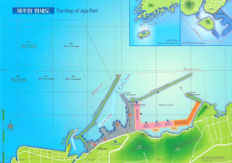
Jeju Port
Leading future, Buautiful Jeju port
Geographical conditions and status
Jeju Port, situated in the north certer of Jeju-do (Island), has implemented the role of logistic center and tourism
supporting port of Jeju area since its opening in July 1927.
For the trouble-free management of vessels and freight entering and departing the port, Jeju Port is equipped with speedy
administration support system including Port Management Information System (PORT-MIS) and Vessel Traffic Service (VTS). Jeju Inner Port
is a multi-functional port dealing with commodities, tangerines, etc based on implementation of Jeju Free International City. Jeju Outer
Port will be developed as an international tourism port considering its excellent scenery.
Current development of port facilities
Jeju Port is the gate port of Jeju Special Self-Governing Province, and coastal liners connecting the Korean mainland converge here. Recently with increase of international cruise ship’s entry to the port, it is developing as an international tourism port.
Harbor limit
The surface of the sea within the line connecting from the starting point of West Breakwater to north latitude (NL) 33°31’21.70“ and east longitude (EL) 126°31’39.69” point, NL 33°31’58.70“ and EL 126°32’20.69” point, NL 33°31’59.70“ and EL 126°33’43.68” point, and the northern end of Goneuldong consecutively.
| Water Area | Tidal Changes | Length of Coastline | Water Depth |
|---|---|---|---|
| 3,540㎢ | 2.1m | 3㎞ | (-)2m ~ (-)11m |
- Busan Regional Office of Oceans & Fisheries 351, Chungjang-daero, Dong-gu, Busan Tel:82-51-609-6114 / Fax: 82-51-609-6219 Copyright (c) 2016 Busan Regional Office of Oceans and Fisheries All Rights Reserved